This 7-day Rwenzori trek begins at Trekkers Hostel (1,450m) and climbs through Afro-Montane forest to Sine Camp (2,596m), with monkeys, birds, and Enock’s Falls nearby. Hikers continue via Kalalama and Mutinda Camp (3,588m), with an option to Mutinda Lookout (3,975m).
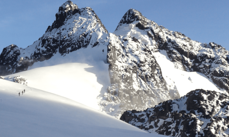
The route passes bamboo, rivers, waterfalls, and valleys with lobelias and groundsel before reaching Bugata (4,100m) and Hunwick’s Camp (3,974m). Day 5 summits Mt Baker (4,844m) with glacier crossings.
Descents pass Oliver’s Pass, Weismann’s Peak, and Kiharo Camp (3,640m), ending along Nyamwamba Valley back to basecamp. Scenic views, wildlife, and peaks highlight the adventure.
7-Day Rwenzori Tour Highlights
- Day 1: Hike to Sine Camp (2,596m)
- Day 2: Hike to Mutinda Camp (3,588m)
- Day 3: Hike to Bugata Camp (4,100m)
- Day 4: Hike to Hunwick’s Camp (3,974m)
- Day 5: Summit Mt Baker (4,844m)
- Day 6: Descend to Kiharo Camp (3,640m)
- Day 7: Descend to Basecamp (1,450m)
Detailed 7-Day Rwenzori Tour Itinerary
Day 1: Hike to Sine Camp (2,596m)
Start from Trekkers Hostel at 1,450m and hike to Sine Hut at 2,596m, gaining 1,146m. Fit hikers may continue to Kalalama Camp at 3,134m, which allows more time later at Mutinda Camp to climb Mutinda Lookout (3,975m).
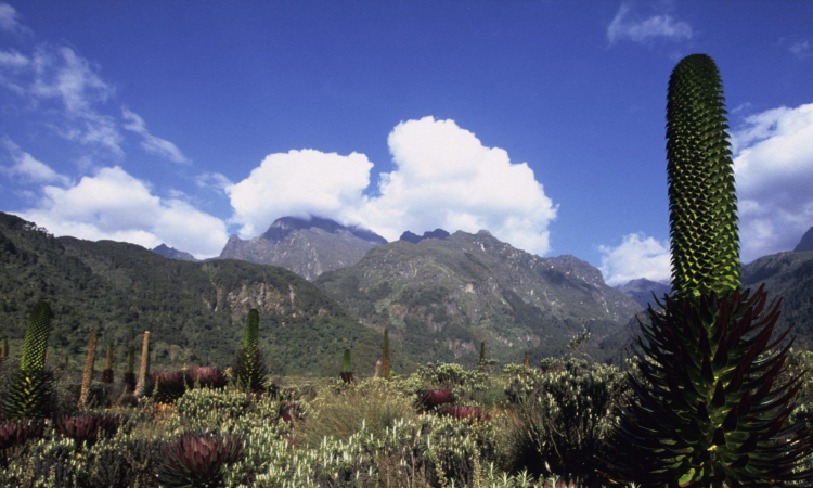
The trail follows the valley floor through tall Afro-Montane forest trees. This steady climb is filled with birdlife, and you may see blue monkeys or groups of colobus monkeys swinging through the canopy. Rarely, L’Hoest monkeys can be seen. You may also hear wild chimpanzees.
The forest has a wide mix of trees, bamboo, flowers, moss, fungi, and vines hanging from the tall branches. Enock’s Falls, just 200m from Sine Hut, is a perfect spot for photos.
Sine Camp has wooden huts on a ridge among tall trees, overlooking a waterfall far below. Visitors often enjoy sitting outside by the campfire, chatting with guides about the mountains and local life. Sine is just below the bamboo zone and surrounded by many bird species.
Day 2: Hike to Mutinda Camp (3,588m)
Trekking begins at 8:30am. Soon you enter the bamboo zone, which is steep and has many high steps. In the wet season it is muddy and slippery. After a climb of 551m over 1.8km, you reach Kalalama Camp (3,147m) for a short rest before continuing.
The trail crosses streams, mossy waterfalls, and follows a river lined with giant heather trees covered with moss and lichen. The valley has many plants and flowers, often misty and atmospheric.
In the afternoon, you may climb to Mutinda Lookout (3,975m) for wide views of the Rwenzori Mountains, Kasese town, and Lake George. This hike also helps with acclimatization.
Sleep at Mutinda Camp, 3,588m.
Day 3: Hike to Bugata Camp (4,100m)
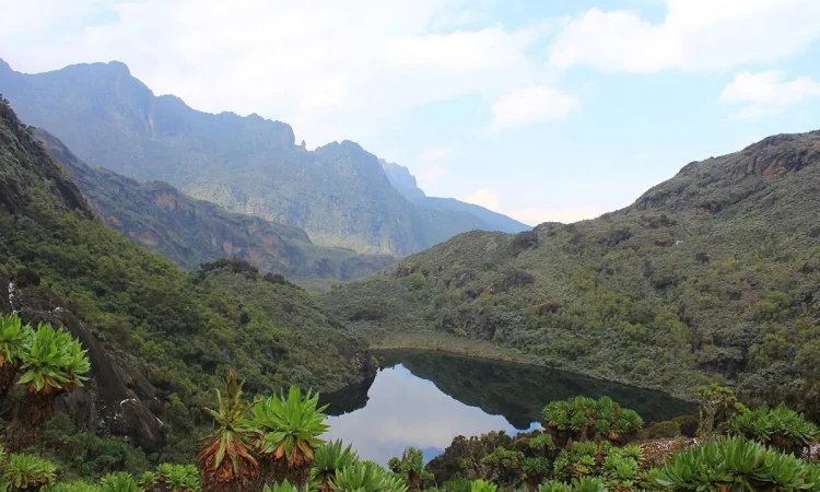
The trail is boggy, especially in the wet season. Boardwalks and careful stepping make it easier. You cross Mutinda Valley, full of tussock grass, everlasting flowers, and giant lobelias, before climbing steeply to Namusangi Valley (3,840m). Waterfalls and views of Mutinda Peaks are seen here. The valley is wide with ups and downs, leading steadily to Bugata Camp at 4,100m.
Day 4: Hike to Hunwick’s Camp (3,974m)
From Bugata, climb up and descend slightly before reaching Bamwanjarra Pass (4,450m). A hut there offers shelter in bad weather. On a clear day, you see the three main peaks. The trail passes bogs, moss, groundsel, and lobelia, where malachite sunbirds feed. Steeper sections follow before a climb to Hunwick’s Camp, set on a ridge with views of Mt Stanley, Mt Baker, Weismann’s Peak, and McConnell’s Prong.
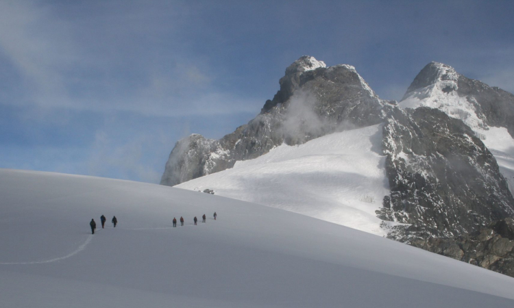
Day 5: Summit Mt Baker (4,844m)
This climb is 4.3km, taking 4–6 hours up and 2–3 hours down. Start at 6:30am. The ascent from McConnell’s Camp (Camp 4) takes 3–4 hours. The trail is steep and rocky, with some narrow crevices near the glacier that require care. Ropes are used for safety.
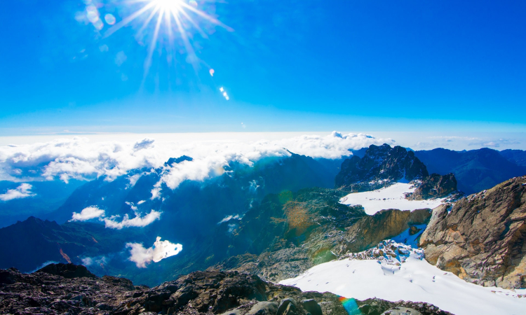
After climbing, you descend a crack in the rock to the glacier, then walk 300m to the peak. In good weather, you see Margherita, Alexandria, Stanley Plateau, and the glaciers. After enjoying the views, cross back over the glacier and descend to McConnell’s Camp for the night.
Day 6: Descend to Kiharo Camp (3,640m)
Distance: 11km, time: 4–7 hours.
From Hunwick’s Camp, climb up a ridge towards McConnell’s Prong for views of the peaks and Scott Elliott’s Pass, then continue to Oliver’s Pass (4,505m). The trail then crosses below Weismann’s Peak to the confluence of the Nyamwamba River.
Here, hikers may choose to climb Weismann’s Peak (4,620m) at an extra cost. On clear days, views of Margherita, Mt Stanley, Mt Speke, and Mt Baker are rewarding.
Continue down the valley to Kiharo Camp, set in a deep valley with cliffs and thick vegetation. Along the way, you pass ridges and mounds left behind by ancient glaciers.
Day 7: Descend to Basecamp (1,450m)
From Kiharo Camp, it is 12.2km to the park gate and another 2.8km to Trekkers Hostel. The walk takes 5–8 hours, so start early if you need to connect to flights or travel.
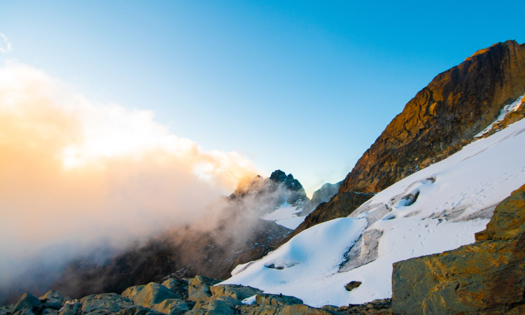
The Nyamwamba Valley descent is mostly downhill. The trail passes moss-covered rocks, waterfalls, forests, and deep valleys. It is one of the most scenic routes in the Rwenzoris. This path took six years to open. In 1937, explorer McConnell attempted this route but failed, and had to turn back. Today, trekkers enjoy the valley he could not pass.
A few kilometers from Kiharo Camp, the path follows the river. In open areas, you may see duikers feeding quietly. At times, you may walk along the river itself, hopping across rocks. Farther down, the river becomes steep with waterfalls, so the trail moves to a ridge to bypass them. Later, you rejoin the river at a rock shelter where you can rest. The forest here is alive with birds, primates, duikers, and hyrax.
This final section makes for a memorable ending to the trek.
For more information you can read 5 day rwenzori weismanns trek and 8 day rwenzori cheptegei trek article.