The trek starts at Trekkers Hostel Kyanjuki, 12 kilometers from Kasese town, past Kilembe copper mines. It is best to start by 8:30am, but you can leave as late as 10am. After meeting your guides for a briefing, you walk 2.2km to the UWA ranger post at 1,727m.
4-Day Rwenzori Tour Highlights
- Day 1: Hike to Sine Camp (2,596m)
- Day 2: Hike to Mutinda Camp (3,588m)
- Day 3: Hike to Kiharo Camp (3,460m)
- Day 4: Descend to Basecamp (1,450m)
Detailed 4-Day Rwenzori Tour Itinerary
Day 1: Hike to Sine Camp (2,596m)
The trail begins by climbing steadily up the valley through tall trees of the Afro-Montane forest. Along the way you may see blue monkeys moving quickly through the trees. Sometimes groups of 15 to 20 black and white colobus monkeys appear in the treetops.
There are also rare chances to see the L’Hoest monkey, which is an important cultural emblem for the Bakonzo people and protected by the Omusinga (King). In the distance, you may hear wild chimpanzees.
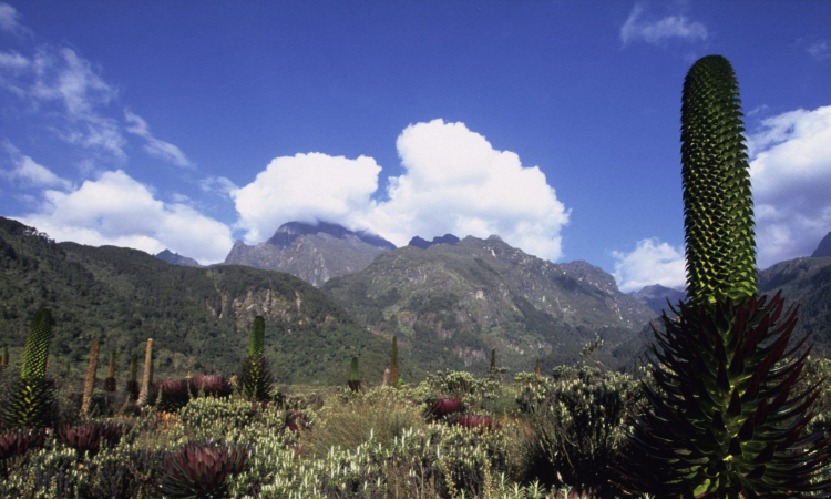
The forest has many plant species, from tall trees and bamboo thickets to shrubs, flowers, fungi, moss, and lichen hanging from the vines. Just 200 meters from Sine Hut are Enock’s Falls, a nice place to take photos and relax.
Sine Camp has wooden huts set on a narrow ridge among tall trees. From here, you can sit and enjoy the view of a waterfall crashing over the rocks far below. Many visitors like to spend the evening around the campfire, talking with guides about the mountains and their culture.
The camp is just below the bamboo zone and attracts many bird species. Only 150 meters away are Enock’s Falls, set among green plants and hanging vines.
Those who are strong enough may continue further to Kalalama Camp (3,134m). Staying there gives you more time the next day to reach Mutinda Lookout at 3,975m.
Day 2: Hike to Mutinda Camp (3,588m)
After breakfast, trekking begins at 8:30am. The trail enters the Bamboo-Mimulopsis Zone. This part is steep, with many high steps, and during the rainy season it is muddy and slippery. After a climb of 551m over 1.8km, you reach Kalalama Camp (3,147m) in the Heather-Rapanea Zone, where you can rest and enjoy tea or coffee before continuing.
From here the trail passes along ridges, small valleys, and streams, with moss-covered waterfalls along the way. The path climbs beside a mossy river flowing under giant heather trees, whose trunks are covered in green moss with lichen hanging from the branches. The valley has many plants and flowers and is often covered in mist, giving it a quiet and special atmosphere.
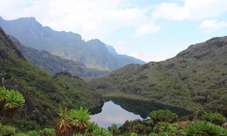
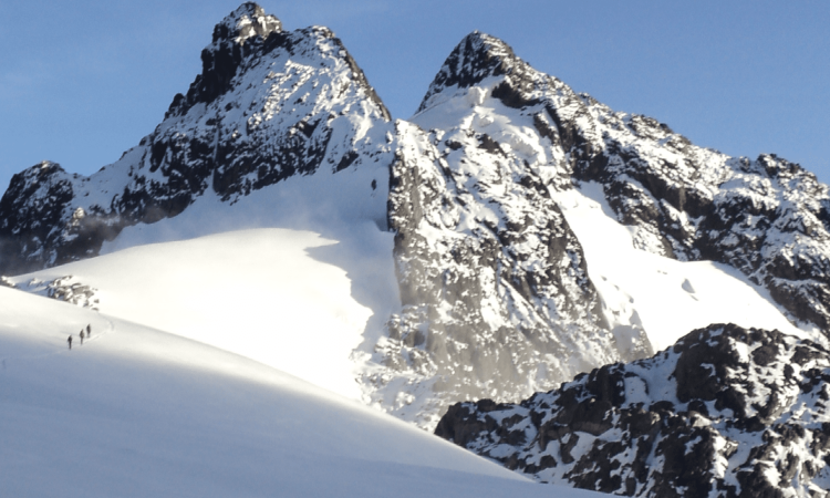
Mutinda Camp is set near a small river and a waterfall where you can wash and rest. In the afternoon, you may climb to Mutinda Lookout (3,925m), a hike of one to two hours up and one hour down. From the top, you can see across the Rwenzori Mountains down to Kasese town and Lake George.
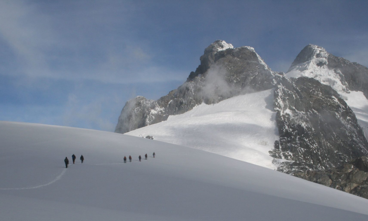
For those aiming to climb Margherita or other high peaks, Mutinda is also important for acclimatization and reducing the risk of altitude sickness.
Day 3: Hike to Kiharo Camp (3,460m)
The day begins with a climb up a rocky riverbed, then across a stretch of bogs before reaching the top of a waterfall. Boardwalks have been built in some sections to make the path easier.
The trail then turns right, climbing a little before descending through Hunwick’s Pass, which passes between the Twin Peaks. If you are alert, you may spot hyrax, red duiker, or see hawks and eagles nesting on the cliffs.
At the bottom, the trail passes through a bog filled with lobelia plants, then continues through tall heather trees and huge moss-covered rocks until you reach Kiharo Camp. About 200 meters from the camp is a tall waterfall pouring over mossy rocks, worth visiting before resting for the night.
Day 4: Descend to Basecamp (1,450m)
The trail down the Nyamwamba Valley is mostly downhill, with rivers, waterfalls, deep valleys, and forest views that are among the most rewarding in the Rwenzori. It took six years to open this trail for tourists. In 1937, explorer McConnell tried to find a way through the valley but failed, turning back to look for another route. Today you can enjoy this path that was once unreachable.
A few kilometers from Kiharo Camp, the path turns right and follows the river. In clearings, you may see duikers feeding quietly. You also have the option of walking directly down the river, hopping across rocks.
Further down, the river becomes too steep with many waterfalls, so the path leads away, following a ridge to bypass these sections. Later, it rejoins the river at a rock shelter where you can rest.
The trail then crosses a small stream, climbs gently, and drops back to the river again to avoid more waterfalls. The forest here is rich with birds, primates, duikers, and hyrax, making this a lively and memorable end to the trek.