The trek starts at Trekkers Hostel Kyanjuki, 12 kilometers from Kasese town, past Kilembe copper mines. It is best to start by 8:30am but you can leave as late as 10am. You meet your guides for a briefing, then walk 2.2km to the UWA ranger post at 1,727m.
5-Day Rwenzori Tour Highlights
- Day 1: Hike to Sine Camp (2,596m)
- Day 2: Hike to Mutinda Camp (3,588m)
- Day 3: Hike to Bugata Camp (4,100m)
- Day 4: Summit Weismann’s Peak (4,620m) and descend to Kiharo Camp (3,460m)
- Day 5: Descend to Basecamp (1,450m)
Detailed 5-Day Rwenzori Tour Itinerary
Day 1: Hike to Sine Camp (2,596m)
The trail begins along the valley floor through tall Afro-Montane forest. The climb is steady, with many birds and a chance of seeing blue monkeys. Groups of 15–20 black and white colobus monkeys are often spotted in the treetops. The rare L’Hoest monkey may also be seen. These are protected by the Bukonzo King, the Omusinga. Sometimes you may hear wild chimpanzees in the distance.
The forest is rich in plant life, including bamboo thickets, shrubs, flowers, fungi, moss, and vines hanging from tall trees. Enock’s Falls, just 200m from Sine Hut, is a great spot for photos.
At Sine Camp (2,596m), wooden huts are set among tall forest trees on a ridge, with views of a waterfall crashing far below. Guests often enjoy sitting by the campfire and chatting with guides. The camp is just below the bamboo zone, with many bird species nearby.
Day 2: Hike to Mutinda Camp (3,588m)
You hike through the Bamboo and Heather-Rapanea Zone, following the trail as it winds over ridges, down into valleys, and across streams. Moss-covered waterfalls and giant heather trees with hanging lichen are common. The trail continues beside a mossy river that tumbles over rocks.
Mutinda Camp is near a small river and waterfall. In the afternoon, you can climb Mutinda Lookout (3,975m). The climb takes 1–2 hours up and 1 hour down. From the top, you see the Rwenzori Mountains, Kasese town, and Lake George. This climb also helps with acclimatization.
Distance: 6.1km, about 6–8 hours.
Day 3: Hike to Bugata Camp (4,100m)
The trail is boggy, especially in the wet season, but boardwalks make it easier. You cross Mutinda Valley with tussock grass, everlasting flowers, and giant lobelias. Then you climb steeply into Namusangi Valley (3,840m), where waterfalls drop from the cliffs and views of Mutinda Peaks appear behind.
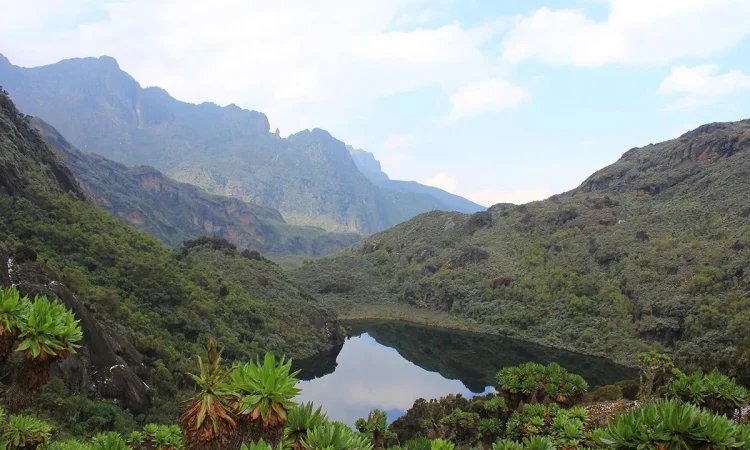
The valley is wide with ups and downs, leading steadily to Bugata Camp (4,062m). Bugata is located high above Bugata Lake at Bamwanjarra Pass. From here, you see Lake Kopello and Weismann’s Peak, often covered with snow, as well as Lake Africa, Lake Kanganyika, and small peaks around Mutinda.
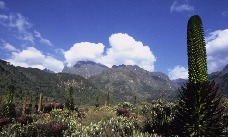
The area is full of alpine plants such as tussock grass, lobelia, St John’s wort, groundsel, and everlasting flowers. Red forest duikers, found only in the Rwenzori, are also seen here.
Bugata Camp has solar lights, toilets, and bathrooms. Warm water can be provided for washing. A helicopter pad is available, though rescue flights are very expensive in Uganda, so insurance is important.
Distance: 4.9km, climbing from 3,588m to 4,100m.
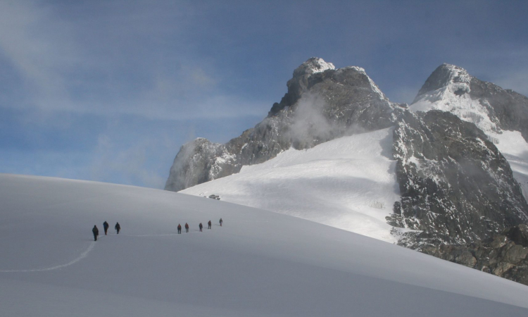
Day 4: Summit Weismann’s Peak (4,620m) and descend to Kiharo Camp (3,460m)
From Bugata, climb 3.7km to the summit of Weismann’s Peak, then descend to Kiharo Camp. The full distance is 9km, taking 4–6 hours.
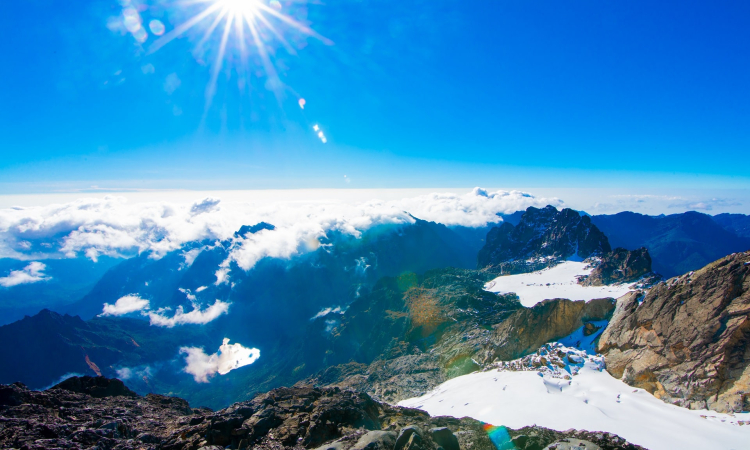
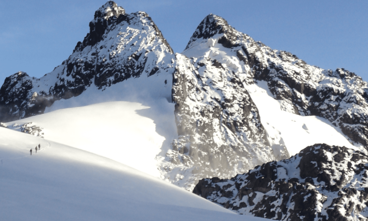
The trail follows the hillside above Bugata Lake, then continues to Lake Kopello, where water temperatures average just 2°C. As you climb higher, you see four lakes along the valley below. The final section to the summit is steep on solid rock. In snow or ice, ropes may be required.
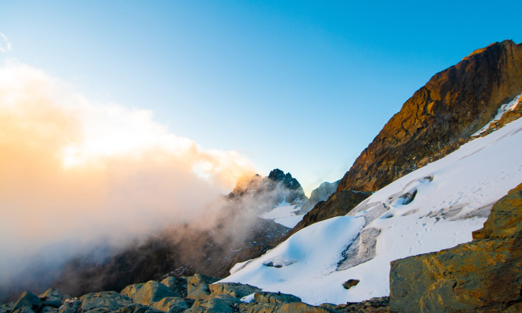
On clear days, the peak offers views of Mt Stanley, Mt Speke, and Mt Baker. The top of Weismann’s Peak is dome-shaped, with deep moss growing over the rocks. Nearby Stella Peak (4,626m) requires technical skills and is not recommended.
From the peak, descend directly to Kiharo Camp (3,460m) in the Nyamwamba Valley. The valley has thick groundsel plants, mossy slopes, and towering rocky peaks. As you continue, you pass flat bogs formed long ago by melting glaciers, with ridges of rocks left behind. The valley is home to red forest duikers.
Kiharo Camp is in a deep valley with evergreen plants and streams. At night, you may hear the calls of rock hyrax from the cliffs above.
Day 5: Descend to Basecamp (1,450m)
The Nyamwamba Valley trail is mostly downhill, with moss-covered rocks, rivers, waterfalls, deep valleys, and thick forest. This section is considered one of the best in the Rwenzori Mountains.
It took six years to open this trail for trekkers. In 1937, explorer McConnell attempted to climb through this valley but failed. Today, you can follow the route he could not complete.
A few kilometers from Kiharo Camp, the trail turns to follow the river. In open areas, you may spot duikers feeding. At times you can walk along the river, hopping across rocks, but lower down it becomes too steep with many waterfalls. The path then climbs a ridge to bypass these sections, before rejoining the river at Riverside Rock Shelter, a good spot for lunch.
After crossing a stream and climbing a gentle slope, the trail returns to the river again to avoid more impassable waterfalls. The forest here is alive with birds, primates, duikers, and hyrax.
This final section is a memorable way to end the trek.
For more information you can read 1 day rwenzori trek and 6 day rwenzori bamwanjara trek article.